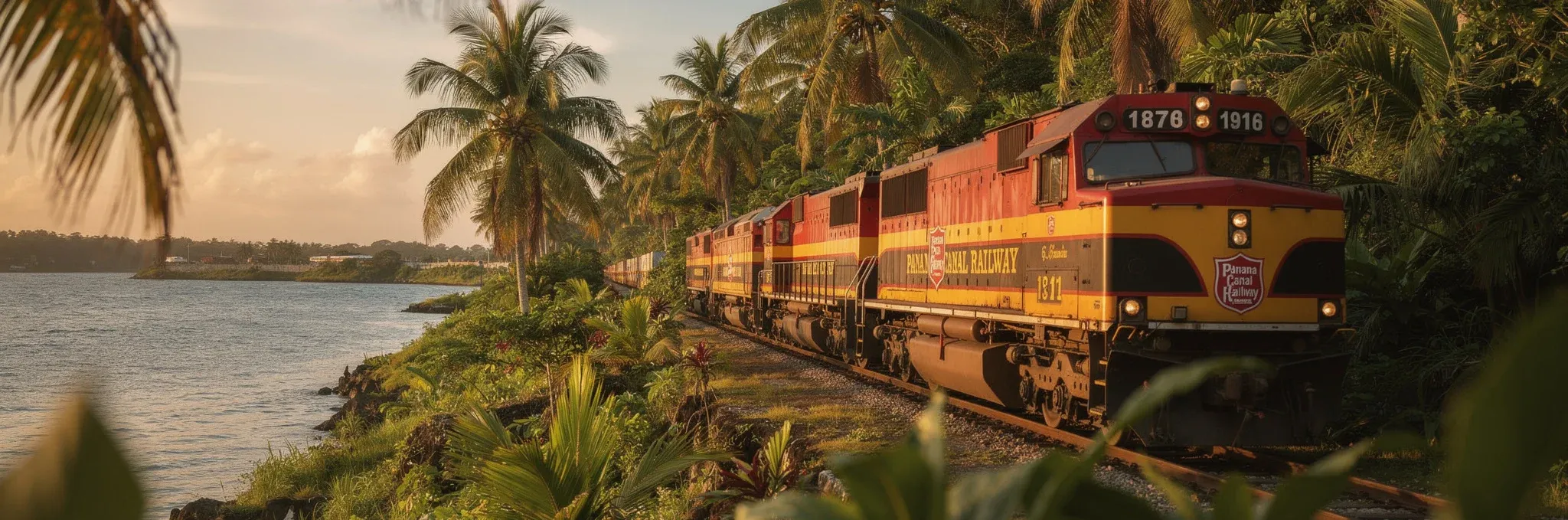
Transisthmian Route Map
47 miles of history, engineering, and biodiversity linking two oceans in less than an hour.
The Historic Route
A path that follows the original 1855 line, renewed to connect 21st-century world trade.
*Interactive map: Use +/- to zoom and drag to explore.
Connecting Two Oceans
PACIFIC
Our southern terminal in Balboa / Corozal is strategically located next to the Port of Balboa and the Miraflores Locks.
- ➤ Direct access to the Port of Balboa (PPC).
- ➤ Main distribution hub for Panama City.
- ➤ Simultaneous loading and unloading facilities.
ATLANTIC
The northern terminal in Colon / Cristobal serves as a nerve center for Caribbean cargo and the Free Zone.
- ➤ Connection with Manzanillo (MIT), Cristobal (PPC) and CCT.
- ➤ Vital access to the Colon Free Zone.
- ➤ Adjacent Colon 2000 Cruise Terminal.
Journey Milestones
Balboa Terminal (Corozal)
System’s Southern Terminal. Strategic hub next to Balboa Port and Miraflores Locks. Departure point for cargo and passengers from Panama City.
Miraflores Locks
Look closely at ships beginning their transit through the Canal and the historic Pedro Miguel locks.
Culebra Cut
The most dramatic point of the journey. The train travels through the Continental Divide, bordering the Canal excavation.
Gatun Lake
The train seems to float over water as it traverses immense causeways surrounded by the artificial lake and virgin rainforest.
Colon Terminal (Cristobal)
System’s Northern Terminal. Gateway to the ports of Manzanillo, MIT, and Cristobal, as well as the Colon Free Zone.